Search the Community
Showing results for tags 'topography'.
-
Hello people, I think this is my first post here but I've been reading the forums since 2012. Right now I'm trying to create a 3D terrain from the contour lines I got, using the DRAPE command. I followed a very simple video tutorial that basically you got all the contour lines equidistant from each other on the Z axis, and select all then DRAPE command and it creates a clean solid 3d terrain. I use Autocad for Mac, and the command isn't working at all, it says it's doesn't exist. Is this normal? I really need this terrain on 3D so I can deliver it to the CNC machine. What are my options? File attached*[ATTACH]64364[/ATTACH] Thank you very much, I hope I posted in the right section. Terreno para maquete 3D (2007).dwg
-
Hello, I need to specify the slope of the streets of a city. I have the elevation points of streets. But, how can I get slopes in Civil 3D? I am working with Civil 3D, but I do not know the procedure for this work. I should create a surface from these points? The surface's triangles must be inside streets (the line of streets should be as breaklines)? Thank you in advance, Mohsen
-
Hi Guys, wondering if you've ever had this issue and have figured out what/why my CAD keeps crashing, and if there are any work arounds/fixes for it.. I have a few different surfaces I've created from lidar and survey data, and they keep crashing my AutoCAD especially when I'm switching between layout tabs, but really doing just about any command haphazardly... I know it's the surface because I can set it to no-display or just turn off the layers and i'm smooth sailing, but with it on i usually crash within 10 minutes. I have a pretty killer computer and it's not that incredibly large a surface, so I'm wondering if it couldn't be something else that's bogging it down...I've tried a few different things but nothing seems to help. getting a littttttttle annoyed, and I've done everything else on the drawing but can't seem to finish because this guy keeps crashing. Any help would be greatly appreciated! Running: Civil 3D 2012
-
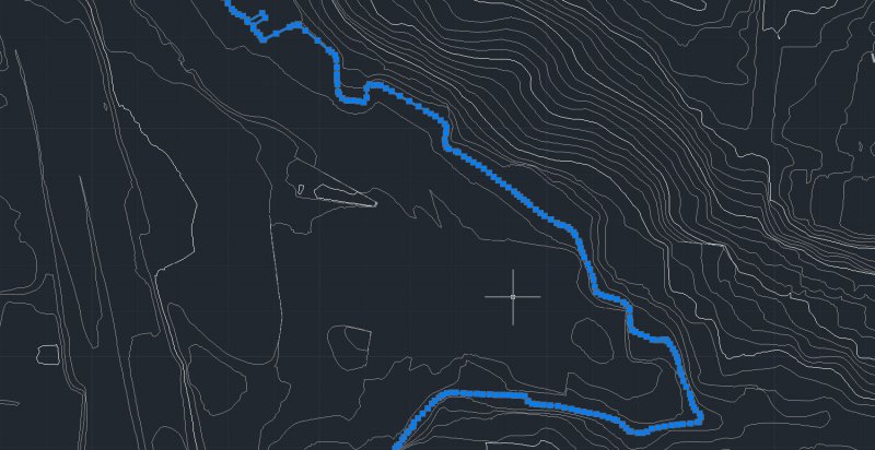
So I'm trying to import this CAD Topo into Revit, and I want to do a layered topo model. It would be much easier and less time consuming if the topo lines were SINGLE lines that I could click once for the outline in Revit, but unfortunately they are a bunch of polylines linked to one another....any way to resolve this, or convert them to become single lines? I've provided an image to show what the condition is, thanks everyone!
-
Right, I’m racking my brain here and I’m finally giving in and looking for assistance from the collective knowledge on the forum. I am having some mapping difficulties with regards to applying a jpeg as a material map onto a surface material. Below are the details. I have a surface model which was generated from topographical information. I have aerial photography of the area the topographical information is based on. The photography covers approximately 1000m2 area. The topography area in contained within this area, it is in the upper right hand corner of the square photo. I have applied planar mapping to the surface I resized the mapping area of the surface to suit the area that the photo covers (I created a boundary rectangle and adjusted the mapping size to suit). I created a customer material using the jpeg photo I applied it to the surface The image scale is set to 1000 All other settings remain as default settings. The mapping displays over my model, but its on the wrong location, i.e. information contained within the jpeg that is out with the topographical area is appearing on the model. When I turn off tiling the mapping disappears from my model completely. I have read a few tutorials today and went back to basics on a few trials by creating blocks and applying the material and scaling it that way. All behave as anticipated. Apart from this. Any help that could be given would be great. Thanks in advance G AutoCAD 2011 Windows XP Professional.

