Search the Community
Showing results for tags 'survey drawings'.
Found 1 result
-
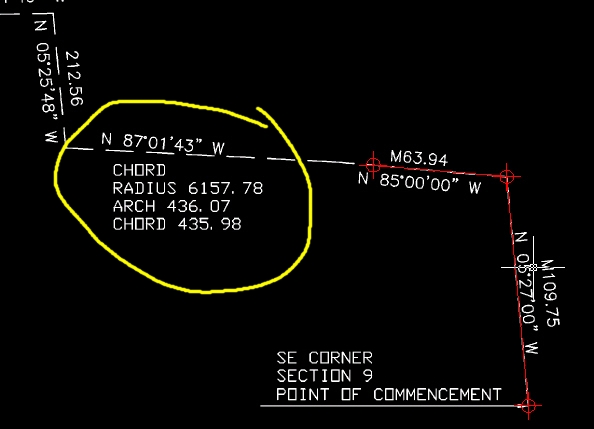
Greetings All, First off, I'm a GIS user using AutoCAD (self taught) to supplement my work, I'm running AC 2005 (plain vanilla, no add ons). I am attempting to digitize from a raster I have attached to my drawing. The image is scaled and rotated appropriately. However, I'm at a loss at how...