Search the Community
Showing results for tags 'survey data'.
Found 6 results
-
I am looking for a lisp that will allow me to convert survey figures to flat polylines. Currently I have to select them explode which makes 3dpolylines then convert to 2dpolylines. I then use the flatten command. I have tried making a lisp that uses (command "_explode") and (command "_flatten") and...
-

Plotting Latitude and Longitude in Vanilla ACAD 2014
dal-designs posted a topic in AutoCAD 2D Drafting, Object Properties & Interface
OK, so I'm an experienced CAD user but have never had to do anything but draw by metes and bounds before, so I need some direction here. I am trying to draw the location of a proposed driveway in vanilla AutoCAD 2014 in such a way that I can bring it into QGIS and/or Google Earth and lay it righ... -

Need help with creating Site Plan from Deed Page
rodjos1000 posted a topic in AutoCAD 2D Drafting, Object Properties & Interface
Hello All, Having a hard time figuring best way to plot this deed. The many radiii are throwing me off and I end up with a triangle. Any help or tutorial would be greatly appreciated. Just need to unlock the first steps. I have done simple plans before, but this one is above my expertise. He... -
I just have normal autocad 2016, nothing fancy like civil 3d. I was wondering, is there a way i can bring in a survey point data file (.txt or .asc) into Autocad. Maybe by something in program by default, or a 3rd party plug in that is compatible with autocad. I don't want to spend way more money fo...
-
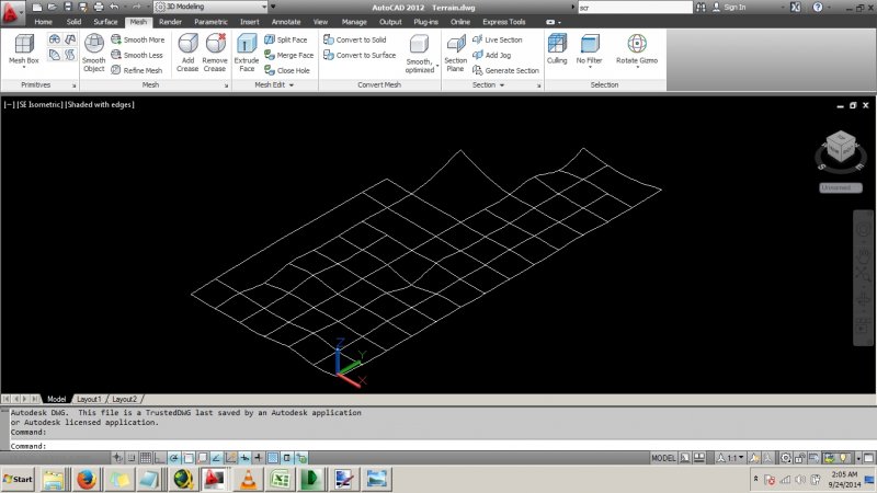
Hi. Is there a simple way to quickly draw a mesh out of the following splines created from a recent survey to represent a terrain. Note some data are missing. Thanks. Terrain.dwg

-
Hi all, I am new to this site and I am an land surveyor using AutoCAD 2012. Just new to 2012 version, previously used 2005 version. My question is: Is it possible to (and how do I) create a 3D model of a ground surface from field survey data which has been collected. The data i have is curr...