Search the Community
Showing results for tags 'mapping'.
-
Hi guys, Bit of a strange request. I'm looking for something that will shift a selection of polygon vertices by a random amount for each vertex. In a perfect world I'd love to set a tolerance of say 5cm and have the vertices move in any x,y direction by random amounts up to 5cm. Any ideas would be appreciated. Cheers Dave
-
Hello, So basically I work for a company which designs and builds cupboards. We have particular textures available (i.e. different types of wood or gloss) I was wondering if it is possible to be able to drag an appearance (a JPEG image) onto an already drawn cupboard and for the mapping to be automatic. So on the front of the cupboard the wood grain should be vertical and on the side of the cupboards it is also vertical but with plain coloured filleted edging. Please could you help to find: 1) How to make a folder of our personal wood grains available from the SolidWorks Screen 2) How to make the mapping automatic so that when applying a certain wood grain it is always orientated in the correct direction along with the correct coloured edges. Any help will be greatly appreciated Thank you very much Sarah x
-
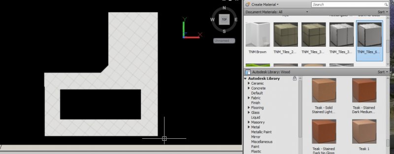
Hi, I am having quite number of problems with applying materials on a project. Each time I apply a 600x600 Floor or Wall Tiles materials, it happens that the tiles are placed at an angle (diagonally) instead of being ortho. I know I can use Planar Mapping with Rotate but there is no option to set an angle. It seemed that modification is applied visually. Is there a way for the material to be applied as per current UCS? One of the edges is diagonal and I believe this is the reason for the materials to be applied diagonally. Thanks in advance for your help.
-
Right, I’m racking my brain here and I’m finally giving in and looking for assistance from the collective knowledge on the forum. I am having some mapping difficulties with regards to applying a jpeg as a material map onto a surface material. Below are the details. I have a surface model which was generated from topographical information. I have aerial photography of the area the topographical information is based on. The photography covers approximately 1000m2 area. The topography area in contained within this area, it is in the upper right hand corner of the square photo. I have applied planar mapping to the surface I resized the mapping area of the surface to suit the area that the photo covers (I created a boundary rectangle and adjusted the mapping size to suit). I created a customer material using the jpeg photo I applied it to the surface The image scale is set to 1000 All other settings remain as default settings. The mapping displays over my model, but its on the wrong location, i.e. information contained within the jpeg that is out with the topographical area is appearing on the model. When I turn off tiling the mapping disappears from my model completely. I have read a few tutorials today and went back to basics on a few trials by creating blocks and applying the material and scaling it that way. All behave as anticipated. Apart from this. Any help that could be given would be great. Thanks in advance G AutoCAD 2011 Windows XP Professional.
-
I have a lot of maps that have drawing units in yards. I'd like to place points on these maps given their lat/long data. Without having the mapping toolbox is there any way to either convert the map units or convert the points? I'm not worried about spherical distortion as the maps are close in.

