Search the Community
Showing results for tags 'landscape architecture'.
-
-
Version 1.0.0
985 downloads
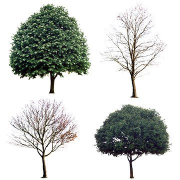
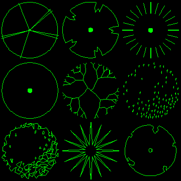
2D Tree Symbols (Collection 1) The plan tree symbols in this pack are compatible with AutoCAD Release 14 and higher. All drawings are relatively small (25-30KB) and are suitable for use as blocks within AutoCAD. They are ideally suited for Landscape Architecture planting plans. The trees have been drawn with a radius of 1 drawing unit. To insert a tree at the required size, simply enter the required radius as the insert scale factor. The trees are all drawn on layer 0, this means that they will adopt the characteristics of the current layer when they are inserted. It is advisable therefore, to create a new layer before insertion so that you can easily control object properties. In each case, the insert base point is in the centre of the canopy. -
Version 1.0.0
3,510 downloads
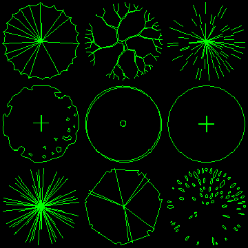
2D Tree Symbols (Collection 2) The plan tree symbols in this pack are compatible with AutoCAD Release 14 and higher. All drawings are relatively small (25-30KB) and are suitable for use as blocks within AutoCAD. They are ideally suited for Landscape Architecture planting plans. The trees have been drawn with a radius of 1 drawing unit. To insert a tree at the required size, simply enter the required radius as the insert scale factor. The trees are all drawn on layer 0, this means that they will adopt the characteristics of the current layer when they are inserted. It is advisable therefore, to create a new layer before insertion so that you can easily control object properties. In each case, the insert base point is in the centre of the canopy. -
Version 1.0.0
1,506 downloads
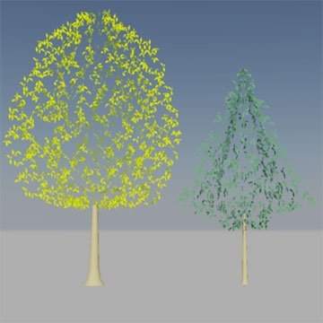
3D Trees (Deciduous and Coniferous) These 3D tree models are compatible AutoCAD R14 and higher. All drawings are suitable for use as blocks within AutoCAD. The trees have been drawn at an appropriate size for a young, standard tree, in metres. To insert a tree at the default size, simply use the default insert scale factor (1). You can always change the X,Y and Z scale factors later using the Properties command. The trees are all drawn on appropriate layers and are unique to each tree so that canopy colour can be changed independently when more than one tree symbol is used in the same drawing. In each case, the insert base point is at the base of the tree trunk in the centre of the tree.-
- tree blocks
- 3d
-
(and 1 more)
Tagged with:
-
Block Description to Multileader LISP help/How to retain block description after WB
eyeofnewt555 posted a topic in AutoLISP, Visual LISP & DCL
Hey guys, first time posting so forgive (and gently correct) any lapses in forum etiquette. So basically I'm trying to automate labeling landscape plans. Looking for a pain-free way to slap an accurate multileader on clusters of blocks, the original of which will have been pulled from a palette. I know what you’re thinking—just use a block name->mleader LISP. Whale, our block names are written in a slightly different format than the desired leader text, for easier lookup. EG: •Block name: Oak-Red •Mleader text: X-Red Oak So an ideal solution: •Needs to pull from palette block description or some attribute other than block name •Needs to be palette-friendly This LISP is really great. BUT, we make our palettes by wblocking each block to its own drawing and then dragging all of those separate drawings into the palette (any other way and the palette moves ridiculously slow). WB saves the block as a drawing and removes block description, meaning the LISP doesn’t work on blocks taken from the palette . So, do y’all know how to rewrite this LISP (is that even allowed—rewriting someone else’s LISP? Sorry, newbie here) to pull the description from the palette display (which I would go through and input) _or_ to retain the original block description through the WB process? Unless y’all can come up with something clever, my workaround is going to be to change the block name to the desired Mleader text (X-Red Oak) and then change the block display name in the palette for easy look-up (Oak-Red), and then use a block name->mleader LISP. This works, but is not ideal—would take an obnoxious amount of time and they’d see “X-Plant Name” when doing bcount (not a huge deal). HALP and thanks!-
- landscape architecture
- lisp
-
(and 2 more)
Tagged with:
-
How do i make series of cross sections of simple landscape
pete84 posted a topic in AutoCAD Beginners' Area
Hello, I'm using Autocad 2014 as a landscape architect student, and I'm still a beginner. I need to make a series of cross-sections to describe a terrain. I have contours of a 100 km stretch (only from 1 to 20 m) and need roughly 50 sections to describe the landscape. Is there a simple way to get the surface line for each section?? I would very much like to avoid making each by hand I did a little research in here and it seems this thread is closest to mine: http://www.cadtutor.net/forum/showthread.php?21255-cross-section it has this "quickprofile.lsp" attached. But i think it has to have the contours on the same layer - i cannot get to work for me. Does anyone have a suggestion for me? Thank you -
Hello, I am a landscape architect, and have used autocad for the past three years, and I am also familiar with microstation, which I used at a previous job. My question is primarily for the users that are familiar with both products. Unlike much of the drafting I have done in architecture (which is often straight lines and 90 angles), landscape architecture and land planning often requires long sweeping curves that lead into tangent arcs, and or lines. Microstation has a brilliant arc tool that allows one to create beautiful curves that are always tangent. The arc tool also allows placement of the next curve anywhere, as opposed to snapping to an end point. Is there a way to do the described actions in Autocad? Again, if you are unfamiliar with microstation's arc tool, my question may not make sense. Thanks for help.
- 2 replies
-
- microstation arc tool
- landscape architecture
-
(and 1 more)
Tagged with:


