Search the Community
Showing results for tags 'grid'.
-

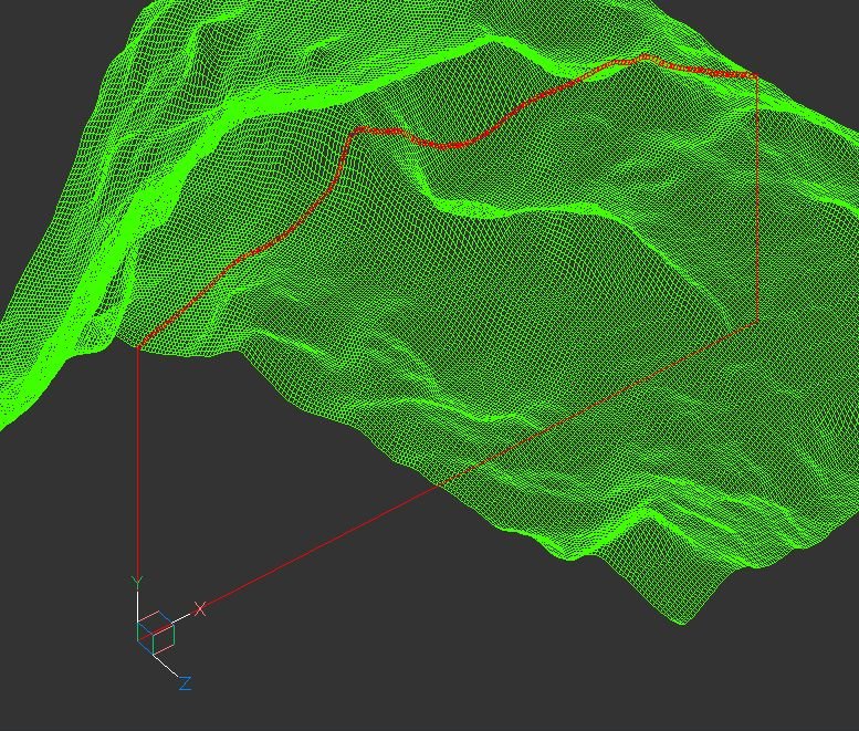
terrain Cross section of the 3D terrain
Andrej Skvarca posted a topic in AutoCAD 3D Modelling & Rendering
Hi guys, I've created an AutoLisp app which creates a cross section of the 3D terrain grid. The terrain can consists of raw AutoCAD entities: MESH / POLYFACE MESH / POLYGON MESH (one or more, even combined). As an author, I will be grateful for any comment, especially suggest...- 12 replies
-
- mesh
- polyface mesh
- (and 10 more)
-
Hello, i want to ask for help with creating closed polygon from Grid lines with lisp. Regards Trudy
-
How do I make grids on walls go away
sarahwestcott posted a topic in AutoCAD 3D Modelling & Rendering
Hi, Newbie here, whenever I use push/pull or extrude the wall I make is gridded. I would rather not see this grid, every tutorial online has clean wireframe walls without grids on them. How do make it go away?! -
Help this topic how to draw grid specific interval Sample GRID.dwg
-
Hello I haven t been able to find an answer by searching the forum so I am starting this topic although it may have been answered before. I am trying to create a volume grid map showing cut fill elevation differences at the grid corners and labels in each grid square stating how much cut fill...
-
Grid and Snap in AUTOCAD LT 2015
steepcreeker posted a topic in AutoCAD 2D Drafting, Object Properties & Interface
It seems that in the 2015 release that you can no longer add a grid to paperspace. This was possible in previous releases. Am I missing something here? Thanks - Phil- 5 replies
-
- grid
- autocad 2015
-
(and 1 more)
Tagged with:
-
Hi, I have googled & found some lisp, which draw grid based on given input on nr.of columns and rows. But i am looking for a draw grid lisp based on given spacing. Please share if you have one like this. Any help will be appreciated. Thanks Manohar. grid.dwg
-

Second Set of Limits GRID in MS and PS! SOMETIMES! HELP!?
tmelancon posted a topic in AutoCAD Bugs, Error Messages & Quirks
I draw with 8"x11" templates with limits set to the 8x11 titleblock we use and the grid is always set to dots. I notice that sometimes, not all the time, in model space and/or in paperspace there is an additional set of grid with limits but it is offset from my limits and my titleblock template? The...- 15 replies
-
- gridstyle
- griddisplay
-
(and 3 more)
Tagged with:
-
Create point on a grid
nargothrond posted a topic in AutoCAD 2D Drafting, Object Properties & Interface
Hi there!! How are u guys?? I have a problem here... the autocad can create points on grid? I must stipulate the points to be sampled in the field / map, and would be a nice increase for the company. I'm sending a map, and I need a point every 2500 m square. I managed to do manually. I picked a...


