Search the Community
Showing results for tags 'gps'.
Found 9 results
-
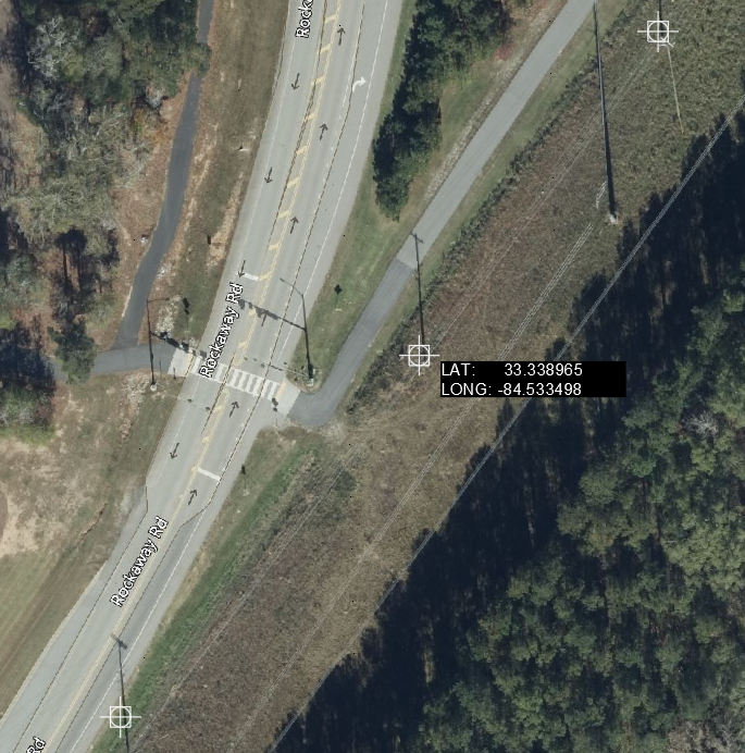
Hello everybody, Currently using Cad 2022 Map 3D, I have around three to four hundred GPS points for existing poles and probably more coming, I'm looking for a way to display their respective Lat and Long on the model space on Mtext format like the sample below, any help would be greatly appreciated. I know that your time is valuable. Thank you 116617090_GPSTest.dwg

-
We've just purchased a new GPS system and are working out various kinks, one of which being that the default logging and point exporting format creates .dwg files with coordinates recorded as (Northing, Easting). Is there a simple way to translate an entire .dwg consisting of text, points, and lines to (Easting, Northing)? Hopefully I'm not forgetting some very, very obvious solution!
-

Is it Possible to view CAD Drawing on google Maps with GPS Location
rameshtrc posted a topic in AutoCAD General
Hi, I want to overlay the cad drawing on Google maps with live GPS location, It is possible in desktop or Laptop but I want it on my mobile device. I am ready to buy the new device for it & willing to buy the paid application. -

Import real time gps coordinates from Leica CS10 to Autocad
cmscardoso posted a topic in AutoCAD General
Hello. Is it possible to import real time gps coordinates from Leica CS10 to Autocad? Is it a function in Autocad or will i need a third part software to accomplish that? Thanks for your help -
Currently working on some as-builts. Wondering if there is any program that will import gps coordinates from my handheld device and place them onto google maps images and then import that image with those gps waypoint into autocad. Thanks in advance
-
Hi, I am having a little trouble with gps coordinates. I am trying to snap to a specific gps coordinate on my layout. I have a "gps block" that spits out the proper coordinates but i am not sure how to move to a specif point. My layout is set up such that when i use my "gps block" on a known point it spits out the northing and easting, however, when i try to actually type in a specif northing and easting, it is no where near the point i am looking for on the layout. Any help on this would be appreciated.
-
Hi there, I am using Autocad LT 2013. I wish to use Autocad to draw subdivision lines and need to overlay satellite imagery (Google Earth or Google Maps) in tandem with Garmin GPS waypoints taken in the field. In the 'type a command' ribbon, when I type in 'GEOGRAPHICLOCATION' and select 'Import the current location from Google Earth' (opens Google Earth, where you can retrieve a location to import). Then a window appears which says 'Navigate to the location in Google Earth that you want to import before continuing (for best results, configure the view in Google Earth to look directly over the location that you want to import). When I select 'continue' the command ribbon asks that I, 'select a point for the location : Can someone please explain what this means? I have looked at the co-ordinates on google earth and attempted to enter but it does not feel right. Then says 'specify the north direction or (angle):s, then 'Point or option keyword required'. Can someone suggest a way to have the ability to draw subdivision lines on satellite imagery. Garmin's Basecamp will allow drawing on top of google earth but I do not want tracks, I will only use the waypoints made by the gps device, but I need to draw measured lines that reflect the co-ordinates of the location. Thanks
-
I just want to start out by saying I know a little bit about cad but I do not know a whole lot about plotting corrdinates. My issue is as follows. I have about 40 gps corrdinates that I took with Droid2Cad which are recorded as lat, long, and alt. The points can be exported to .dxf and .kml(google earth). I have exported them to both and it looks like google earth plots them correct but I have issues with the .dxf file. I have a .dwg site plan of an agriculture site from a engineering firm that seems to be drawn at 1:1. When I go to overlay the points on the site plan the points end up way off off the site plan. I dont know if I need to scale the .dxf or what. The points seem to be in the right configuration but they dont land anywhere close to the right spots. When I overlayed the points on the .dwg, I selected all the points, copied with a base point on a point that I knew the corresponding point on the .dwg, and pasted that point to the point on the .dwg. I dont know if I did a good enough job explaining this but I would appreciate any help anyone can give me. If you need more info or clarification please let me know. Thank you for your time. Aaron Daniels
-
Newbie here with a question. I have just begun to explore autocad 3d 2008. I have been through the tutorials and have watched everything on you tube I could find. Therefore, I barely know anything about autocad. My question is, can I upload a map of the county/parish I live in then draw its boundaries? I would then like to layer the gps coordinates of objects that were found throughout the parish? I am studying the distribution of a certain plants in a couple of counties. As I locate one and mark the gps coordinates, I would like to upload it to a map where people can look at the map and see where I have collected plants. Can anyone give me details on how to do this and, if you have time, why I need to do it the way you suggest. I am not yet familiar with the autocad jargon so please be gentle. Thanks in advance.