Search the Community
Showing results for tags 'freeze up'.
Found 1 result
-
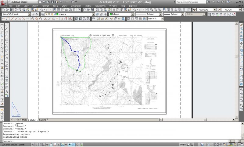
Hello Everyone. I'm drawing polylines within a chart of elevation contour lines of a mountainous region in my country. This is for the design of the drainage hydraulics of highways. The Contour Chart which is in jpg format, I have saved it in photoshop in medium size to help make my autocad drawing the less heavier in size. In fact, my AutoCAD dwg file is only 69 KB big. I have however georeferenced my Chart by UTM coordinates, so it is a little bit big in the drawing. My drawing is in milimetres and the chart size is: 3861 x 2848. Here is the layout view of my drawing: What is making my AutoCAD crash all the time when I regenerate the model? Is there anything I can do to stop this from happening? I try to save my drawing all the time though, and whenever my AutoCAD crashes I have to close it up, then I have to open AutoCAD and the drawing again; but this is a bit tedious.