Search the Community
Showing results for tags 'contour'.
-
In this tutorial you will learn how to create contour lines from Google Earth on AutoCAD:
-
Hi Everyone:) I am working with contour lines. I don't have any trouble creating a surface from the contour lines (Toolspace > GIS topo > Definition > Contours > Add (with swapping edges selected) >> surface generates). What I was wondering is : IS there any way to create different layers for d...
-
I want lisp to get label at the polyline starting edge and ending edge
sanju2323 posted a topic in AutoLISP, Visual LISP & DCL
I want lisp to get at the beginning and end of each polyline of the Elevation Label Label Sample.dwg -
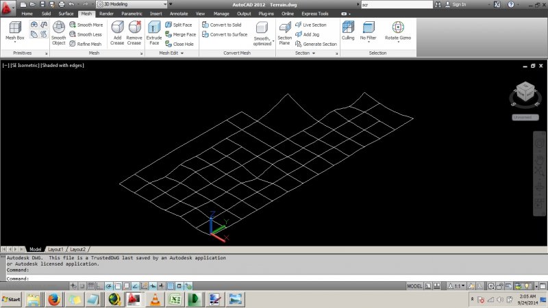
Hi. Is there a simple way to quickly draw a mesh out of the following splines created from a recent survey to represent a terrain. Note some data are missing. Thanks. Terrain.dwg
- 1 reply
-
- survey data
- mesh
-
(and 2 more)
Tagged with:
-
Hi, I've had this ongoing problem where, when Clipboard>Copy(ing) contour lines and triangles, there always seems to be one contour line with a ridiculous elevation. i.e if all my contour lines were around an RL of 60-70 (as an example, this happens regardless of the spread or elevation of the R...
-
How to create surface or solid from contour lines?
mihailklenov posted a topic in AutoCAD 3D Modelling & Rendering
Hello, there! For several days now I've been trying to lay a mesh on top of some contour lines. I've also tried the loft command, but with little success. I've tried several terrain plugins, but they all seem to misfunction because I have overlapping contours. Here is the dwg to get idea what I'... -
Hello, I am pretty new to LDD and can not figure out how to crate a TIN from design contours. The design contours are polylines. If there is a step by step tutorial on how do do this, that would be great. I have been looking but have not found anything. Thanks for the help!
-
Hi friends,is it possible to make 3d contour by using coordinates like x,y,z.that means if i putting value of xyz can i made 3d contour.thanks in adv.
-
Creating a surface or solid from a Contour Map?
Sian posted a topic in AutoCAD 3D Modelling & Rendering
Hi, I have a contour map in polylines in the correct elevation and I was wondering how I can make it into a surface? I have read many threads and searched the AutoCAD Architecture 2010 user documentation but cannot find a "drape" command which everyone seems to suggest from other peoples posts.... -
Is there a way to prevent a viewport from showing behind an object drawn in paper space? It's not attached to the side of the title block so I can't _vpclip around it. It's floating in the lower left corner, and I don't want the contour lines on this map to show up behind it.
- 6 replies
-
- paper_space
- mask
-
(and 3 more)
Tagged with:


