Jump to content

Search the Community

Showing results for tags '3d map'.

  • Search By Tags

    Type tags separated by commas.
  • Search By Author

Content Type


Forums

  • CADTutor
    • News, Announcements & FAQ
    • Feedback
  • AutoCAD
    • AutoCAD Beginners' Area
    • AutoCAD 2D Drafting, Object Properties & Interface
    • AutoCAD Drawing Management & Output
    • AutoCAD 3D Modelling & Rendering
    • AutoCAD Vertical Products
    • AutoCAD LT
    • CAD Management
    • AutoCAD Bugs, Error Messages & Quirks
    • AutoCAD General
    • AutoCAD Blogs
  • AutoCAD Customization
    • The CUI, Hatches, Linetypes, Scripts & Macros
    • AutoLISP, Visual LISP & DCL
    • .NET, ObjectARX & VBA
    • Application Beta Testing
    • Application Archive
  • Other Autodesk Products
    • Autodesk 3ds Max
    • Autodesk Revit
    • Autodesk Inventor
    • Autodesk Software General
  • Other CAD Products
    • BricsCAD
    • SketchUp
    • Rhino
    • SolidWorks
    • MicroStation
    • Design Software
    • Catch All
  • Resources
    • Tutorials & Tips'n'Tricks
    • AutoCAD Museum
    • Blocks, Images, Models & Materials
    • Useful Links
  • Community
    • Introduce Yourself
    • Showcase
    • Work In Progress
    • Jobs & Training
    • Chat
    • Competitions

Categories

  • Programs and Scripts
  • 2D AutoCAD Blocks
  • 3D AutoCAD Blocks
  • Images
    • Backgrounds

Find results in...

Find results that contain...


Date Created

  • Start

    End


Last Updated

  • Start

    End


Filter by number of...

Found 2 results

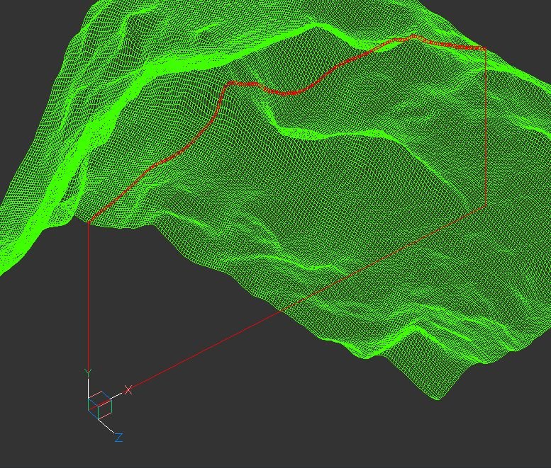
  1. Hi guys, I've created an AutoLisp app which creates a cross section of the 3D terrain grid. The terrain can consists of raw AutoCAD entities: MESH / POLYFACE MESH / POLYGON MESH (one or more, even combined). As an author, I will be grateful for any comment, especially suggestions for improvements and developments. Andrej Skvarca TERRAIN_CROSS_SECTION.fas
  2. barefootbob

    GIS and Animation in Map 3D

    Two Questions: 1) can i import shape files into the same .dwg file using two separate coordinate systems? ie: WGS 1984 (LL84) while the majority of my data is on the IL83 coordinates? 2) Once the 'draping' of my files have been placed over the ariel image file for the terrain, can I use map to do a 'flyover type animation' or would I have to move on to something more complex such as Max? Thank you. Bob
×
×
  • Create New...