Leaderboard

Popular Content
Showing content with the highest reputation on 03/04/2021 in all areas
-
Perhaps this? http://www.lee-mac.com/steal.html3 points
-
The only object on layer ROAD is a block and I am struggling to find it within your survey area. I inserted it again and so it does exist. Played and moved a pline over your survey but it does not match the lines there. Anyway if you want a road to match the surface I use Civil Site Design a CIV3D add on and depending on accuracy would just use normal cross sections spacing and make design levels match the surface. So get all levels. If I want tighter model then would do say 1m spacing. There is also the ability in CIV3d to drape a pline onto a surface, so again the more segments the more it reflects the shape of the surface. Projecting 2D line or polyline onto Civil 3D surface | Civil 3D 2019 | Autodesk Knowledge Network2 points
-
Hi Dana, it is active and I have it set for "2". All is working perfect now, thank goodness!1 point
-
Like f700es I play on the edges with 3d, but if you have never done anything in terms of solids then the chair is very ambitious. Start with extrude, union, subtract, rotate3d, to mention a few commands. There is some tutorials around or look for a book. May get some ebooks now cheap.1 point
-
This is a later version has a 2020 revision GetExcel.lsp1 point
-
New as in not from day one I guess. At my age, automatic transmissions seem new.1 point
-
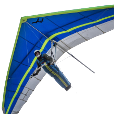
I sometimes take the track log from the old GPS I use when hang gliding to create a kml file that I can use to see my flight in Google Earth. All you need is an text editor (I use Notepad++) to create the file. You can use the following code (the start of one of my flights) and substitute your coordinate data via cut and paste to draw a path from your data. I've left some of my coordinate data in the file of the start of my flight so you can see what it should look like. You should of course replace these values with your data. You may also want to replace the altitudemode value of "absolute" with another value if you just want the path on the ground and not in 3D. <?xml version="1.0" encoding="UTF-8"?> <kml xmlns="http://earth.google.com/kml/2.0"> <Placemark> <name>Location label here</name> <LookAt> <!--Substitute your starting longitude and latidue coordinates in the next 2 lines then adjust the range tilt and heading values to what you want. --> <longitude>-72.45866667</longitude> <latitude>43.44385</latitude> <range>600.00000</range> <tilt>60.0000</tilt> <heading>120.0000</heading> </LookAt> <Style> <LineStyle> <color>ff9900ff</color> <width>4.0</width> </LineStyle> </Style> <LineString> <tessellate>1</tessellate> <altitudeMode>absolute</altitudeMode> <coordinates> <!-- Substitute your longitude, latitude, and altitude values for as follows--> -72.45866667,43.44385,875.0808 -72.45865,43.44383333,877.824 -72.45863333,43.44383333,877.2144 -72.45863333,43.44383333,880.5672 -72.45863333,43.44383333,878.7384 -72.45866667,43.44381667,880.2624 -72.45873333,43.44385,877.824 -72.45873333,43.44385,878.4336 -72.45873333,43.44386667,877.2144 -72.45871667,43.44391667,876.3 -72.4588,43.44393333,876.9096 -72.4588,43.44398333,878.4336 -72.4588,43.44401667,877.824 -72.45878333,43.44403333,878.4336 -72.45873333,43.44401667,877.2144 -72.45878333,43.44401667,877.2144 -72.45898333,43.44603333,887.5776 </coordinates> </LineString> </Placemark> </kml> Sample KML.kml1 point
-
Been asked before, pretty sure must be lat long so 1st problem, you can open a webpage including Google map, will try to find, I think over at Forums/autodesk I know I posted code with a known location example. A quicky (command "_BROWSER" "https://www.google.com.au/maps/@-33.8586988,151.2162374,15z") Sydney famous landmark.1 point
-
Sounds like you need a new draftsman. Can they explain exactly what the concern is about? Since what I draw on company time belongs to the company, I am required to send what my bosses ask me to send.1 point